DL Services SPRL
Rue Vanderborght 24
1081 Brussels Belgium
info@dl-servi.com
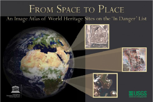
From space to place: an image atlas of world heritage sites on the 'in danger' list
Available
The concept for this book, and the partnership to produce it, were born during conversations held at an international workshop in Campeche, Mexico, in late November of 2005. The workshop was entitled “The Use of Space Technologies for the Conservation of Natural and Cultural Heritage”, and featured speakers from United Nations organizations, space agencies, universities, and conservation groups.
Génération de facture pro forma disponible dans le panier.
Two of the keynote speakers, Mario Hernandez, Senior Program Specialist for Remote Sensing for the United Nations Educational, Scientific and Cultural Organization (UNESCO), and Barbara Ryan, then Associate Director for Geography at the United States Geological Survey (USGS), were inspired to extend the outcomes of the conference to include a collaboration to develop this book. They shared a vision for the production of an atlas of satellite imagery for the set of World Heritage sites on the ‘In Danger’ list. The atlas would emphasize the utility of satellite imagery for assessing and managing these endangered protected areas.


